Little River Drainage District
When people think of Southeast Missouri's landscape today, many conjure up images of the small, rural towns that dot the area or perhaps the region's vast and productive farmland. But it's doubtful most think of the work that began more than 100 years ago today on the Little River Drainage Project.
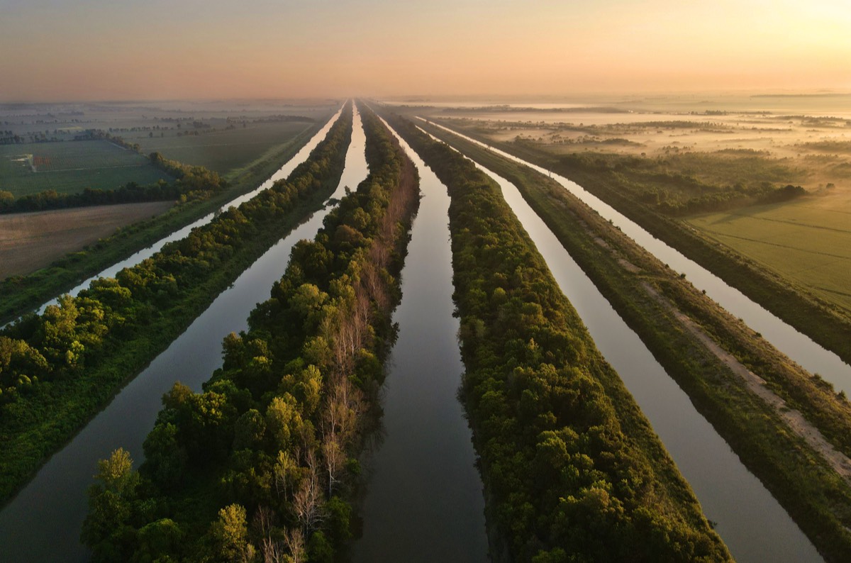
Before the construction of levees that harnessed the floodwaters of the Mississippi and Ohio rivers, Southeast Missouri was a natural basin for their overflow and also served as a water deposit for the Ozark streams that flooded out from the hills and twisted across the region. The result was nearly 2 million acres of swampy and overflowed land deemed unfit for cultivation and inhabitation, nicknamed "Swampeast Missouri."
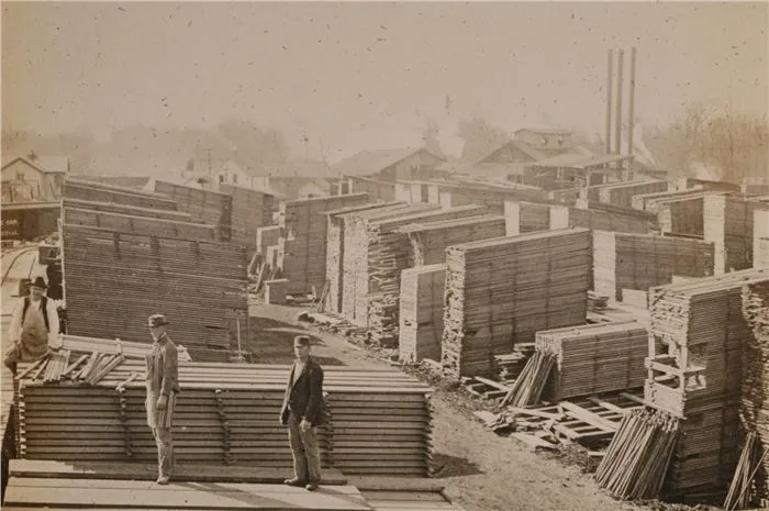
The land, initially owned by the U.S. government, was granted to the state of Missouri through the Swamp Land Act of 1850. But, not knowing what to do with it, the state conveyed the land to the counties encompassed by the great swamp, who in turn sold the land at a low cost to private entities with the stipulation that the land be developed and drained. But, by the end of the 19th century, the only thing being drained from the swamp was its timber.
Before the construction of levees that harnessed the floodwaters of the Mississippi and Ohio rivers, Southeast Missouri was a natural basin for their overflow and also served as a water deposit for the Ozark streams that flooded out from the hills and twisted across the region. The result was nearly 2 million acres of swampy and overflowed land deemed unfit for cultivation and inhabitation, nicknamed "Swampeast Missouri."
The land, initially owned by the U.S. government, was granted to the state of Missouri through the Swamp Land Act of 1850. But, not knowing what to do with it, the state conveyed the land to the counties encompassed by the great swamp, who in turn sold the land at a low cost to private entities with the stipulation that the land be developed and drained. But, by the end of the 19th century, the only thing being drained from the swamp was its timber.
"The timber companies came in and cut as much timber from the swamp's forests as they could," said Dr. Joel Rhodes, history professor at Southeast Missouri State University. "When that was gone, the land returned to its previously worthless state. Then people started to think about ways to make the land become valuable again."
What happened next was the incorporation of the Little River Drainage District in 1907 by a group of men who had been involved with timber interests and now wanted to create farmland and enterprise zones out of the swamp. The district's original five-member board of supervisors, which included names like Matthews and Himmelberger that were synonymous with wealth in Southeast Missouri, knew that by draining the swamp they could increase the value of the land and sell it for development.
The new district, named for a tributary of the St. Francis River, included almost 560,000 acres in parts of seven Bootheel counties -- Bollinger, Cape Girardeau, Dunklin, New Madrid, Pemiscot, Scott and Stoddard. There had been plans dating back to the 1840s to turn the swamp into farmland, but the task was so enormous the plans were never acted upon. Some area farmers had even tried to do the job on their own with a piecemeal approach. The supervisors issued bonds and received other financing for the project from landowners who agreed to pay taxes on their holdings, and the project was eventually launched Oct. 4, 1912.
But not everybody was happy with the district's proposal to drain the swamp. Louis Houck, a prominent civic leader and landholder at the time, fought the district's development plans
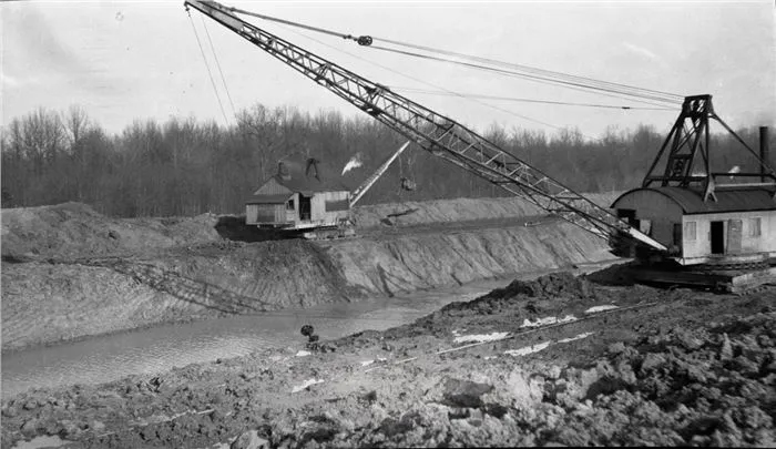
By 1928, after 16 years of long and tedious work and at a cost of more than $11 million dollars, the district had built nearly 1,000 miles of ditches and more than 300 miles of levees, and had drained 1.2 million acres of swamp land in a project that at the time was the largest in the history of the world. When the drainage work was completed, more than 1 million cubic yards of earth had been moved, more than was displaced during the construction of the Panama Canal.
The work that began more than 100 years ago on the Little River Drainage District has provided many benefits to Southeast Missouri. Land that was once 95 percent covered in water and trees now accounts for one third of Missouri's agricultural income. The roads that were built during and after the project provide the lifeline for the region's economic development. The Headwaters Diversion Channel—created from land once owned by Louis Houck—collects water from area rivers and creeks and funnels them into the Mississippi River and away from vital farmland. And the system's 1,000 miles of ditches carries the remainder of the district's low-velocity water into Arkansas, where it flows into that state's collection system and eventually enters the Mississippi River at Helena, Ark.
Things would be completely different in Southeast Missouri if not for the project undertaken 100 years ago. Interstate 55 probably would not have been built due to the cost. The same can be said about most of the highways around Cape and further south. There would be little if any rail activity, and Southeast Missouri's farm economy would be a shadow of what it is today.
(Credit: Delta Dunklin Democrat)
Kennett Chamber of Commerce
1601 First Street
Kennett, Missouri 63857
(573) 888-5828 • Contact Us
1601 First Street
Kennett, Missouri 63857
(573) 888-5828 • Contact Us